 When Annie and I set off to Paradise Island the sky was threatening. We had planned our trip to coincide with low tide. The Bounty Bars were packed, we were wearing our waterproof trousers and nothing was going to stop us.
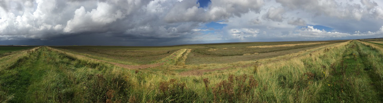
 Leaving the car at Ongar Hill out on the Terrington marshes we turned left along the sea wall. Depending on your point of view, there was either nothing to see or there was an amazing vista of salt marshes bisected by saltwater muddy creeks where the mouth of the river oozes into the Wash. The sky was huge and constantly changing, grey chasing blue. I had my trusty Lumix camera but had recently been on an iPhone photography afternoon and was interested to try out some new photography apps.
As we followed the path, part of the Peter Scott trail, we could see our island from a long way off as a small mound on the otherwise flat horizon. There are two islands. The first is some half a mile out from the sea wall and connected by a soil causeway. The second is visible nearly two miles out into the Wash near the bombing range. They were made in the mid-1970s when there were plans to build a sand wall across the Wash and turn it into a huge freshwater lake. These two trial banks were apparently made to test the theory. A friend had named the closer one Paradise Island as on Google satellite view it has the appearance of a pacific atoll!
 It was about 4 miles walking to the island. The causeway turned out not to be the raised thoroughfare we had expected but a wet muddy path across the marsh, so hidden in the flat land that somehow we walked straight past the start of it and only spotted it sloping down the bank when we turned back. A line of white posts had distracted us — we imagined they marked the way but they just stretched in an enigmatic line far into the distance. There were wooden plank bridges across muddy creeks and we sloshed our way to the start of the rise, pausing to pick and eat some samphire growing along the way.
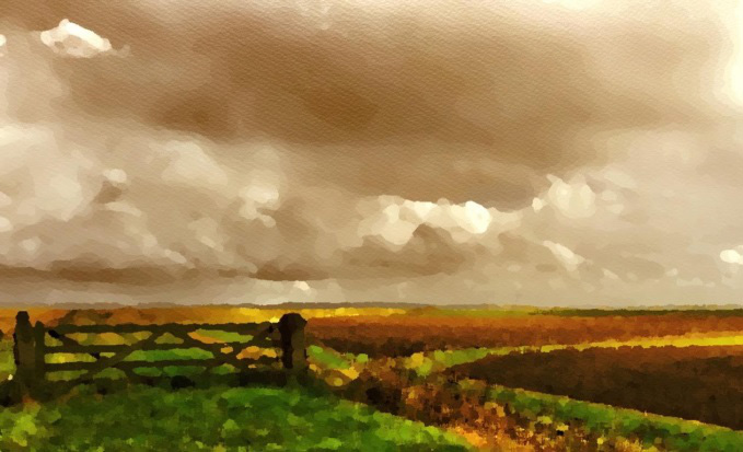
I enjoyed experimenting with the iPhone apps manipulating the pictures into instant “paintings”. The results give a different way of looking and inspiration for art works. Apps I used included VSCO, which has a focus and an exposure button, which you can split on the screen. If you push the exposure button to different areas it changes the appearance dramatically. VSCO also has some editing tools. Enlight app offers “artistic” editing tools that are fun to use. The Waterlogue app turns any photo into a facsimile of a watercolor.
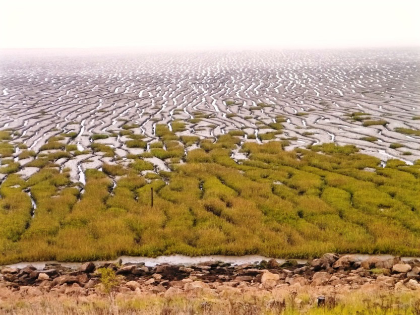
 We puffed our way up to the top of the Island and were rewarded with a view expanding in the distance to include the whole coast from the mouth of the Ouse along to Hunstanton, with visible landmarks such as the church at Snettisham. Behind us the flat fenland fields were a patchwork of browns and green. Immediately in front of us rocks were piled in a protective crescent halfway around the base of the island and the creeks formed intricate patterns through the mud flats.
Finding two handily placed rocks we sat down to rummage for our sandwiches and then the ceremonial Bounty bars. As we munched we contemplated the fact that we could see from our vantage point that the earth is flat and if we had the means to walk through the mud we could walk onwards and fall off the edge. The silence was profound. The few birds we could see also seemed lost in contemplation. The light changed every few minutes and again there was nothing and everything to see.
 On the walk back under stormy skies we surprised a buzzard. Despite having the camera in one hand and the iPhone in the other I just took pleasure from the sight as it rose up in front of us from behind the bank and wheeled away. Walking along the top of the bank gave us great views of the contrast between the wild marshland on the seaward side and the acres of rich dark fenland soil ploughed on the landward side.
 We made sure we went at low tide but I think it is only on the highest spring tides that the causeway is covered. The whole Peter Scott walk is about 10 miles from West Lynn to the lighthouse at Sutton Bridge. If you like huge landscapes where the only features are man-made sea defences, experimental islands and mud all overlain with huge skies then I can recommend a walk to Paradise Island.
Michele Summers